Long-Term Assistance to the National Emergency Management Cause
In recent years, with the rapid development of my country's civil drone technology and market, the role of drones in the field of emergency rescue has become more prominent, and has been fully applied to pre-disaster hidden danger monitoring and response verification, real-time investigation and emergency response during disasters, Post-disaster loss assessment, repair and reconstruction and other emergency rescue links. UAVs have unique advantages and broad development prospects in the fields of aerial reconnaissance, fire rescue, emergency rescue, and emergency response due to their simple operation, flexible maneuverability, high safety, comprehensive vision, and strong scalability.
The National UAV Emergency Monitoring Cooperation Mechanism for Major Natural Disasters was established in 2010. The goal of this cooperation mechanism is to improve the emergency response speed and capability. Quickly respond to major disaster emergency relief work. This award marks that Foxtech Robot has officially joined the "National Team", long-term assistance to the national emergency management cause, and positive contributions to improving my country's disaster emergency support capabilities.
Over the years, Foxtech Robot and its partner users have participated in dozens of emergency rescue missions and accumulated a lot of emergency rescue experience.
Geological Disaster Rescue
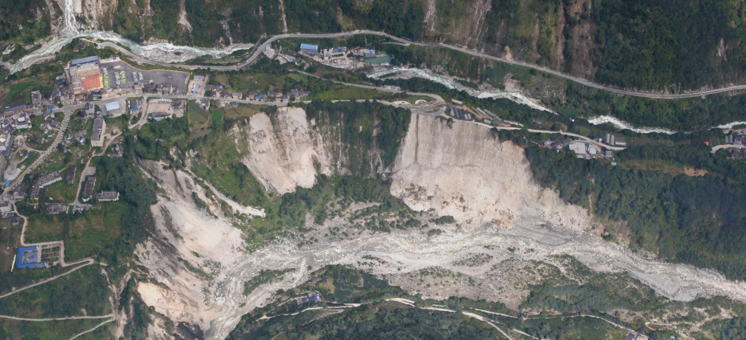
At 12:52 on September 5, 2022, a magnitude 6.8 earthquake occurred in Luding County, Ganzi Prefecture, Sichuan Province, with a focal depth of 16 kilometers and an average altitude of 2684 meters within 5 kilometers of the epicenter. Hailuogou, located at the epicenter of the earthquake, has the lowest and largest marine modern glacier in Asia, and is the only "Glacier Forest Park" in China. In order to understand the damage to Hailuogou caused by the earthquake, Foxtech Robot, together with the Chengdu Institute of Mountain Hazards and Environment, Chinese Academy of Sciences, was entrusted by Sichuan Metallurgical Engineering and Design Group Co., Ltd. to conduct drone aerial photography of the affected area. The highest point of the operation area is 3,728 meters above sea level, the lowest point is 1,544 meters above sea level, and the elevation difference of the survey area exceeds 2,000 meters.
Forest Fire
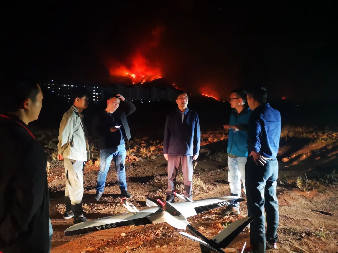
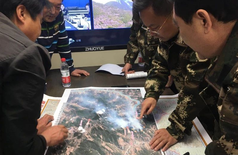
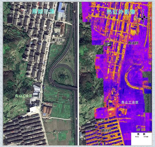
In March 2020, forest fires broke out continuously in Mianning County, Muli County, and Xichang City, Liangshan Prefecture, Sichuan Province. The emergency support team of the Surveying and Mapping Emergency Support Center of the Sichuan Surveying, Mapping and Geographic Information Bureau arrived at the scene of the Muli fire. Facing adverse conditions such as strong winds of magnitude 7, 4,000 meters above sea level, high mountains and deep valleys, the emergency support team used the Pegasus V100 UAV system to carry visible light, infrared Sensors and other equipment carry out night flights to quickly obtain thermal infrared monitoring video of the fire scene and surrounding areas, and send the thermal infrared video back to the Provincial Forest and Grassland Fire Prevention Command Center in real time through the 5G network. At the same time, the remote sensing image map of the disaster was obtained, which provided an important decision-making basis for the ground command center and strongly supported the emergency rescue and disposal work.
Public Safety
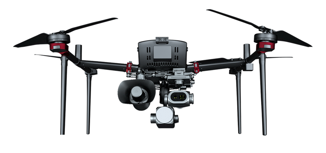
On the afternoon of June 13, 2020, on the highway near Liangshan Village, Daxi Town, Wenling City, G15 Shenhai Expressway, a tank truck exploded, causing the surrounding houses and factories to collapse, causing casualties and property losses. Taizhou Municipal Bureau of Natural Resources and Planning received the disaster alert and immediately dispatched an emergency surveying and mapping support commando team to the accident site with the Pegasus D200 UAV system, providing the front headquarters of the Zhejiang Provincial Fire Rescue Corps with geographic information results, thematic maps, Geographic information support services such as on-site video information, post-disaster high-resolution images, and 3D tilt models.
Mapping by Taizhou Geographic Information Surveying and Mapping Center
Rescue
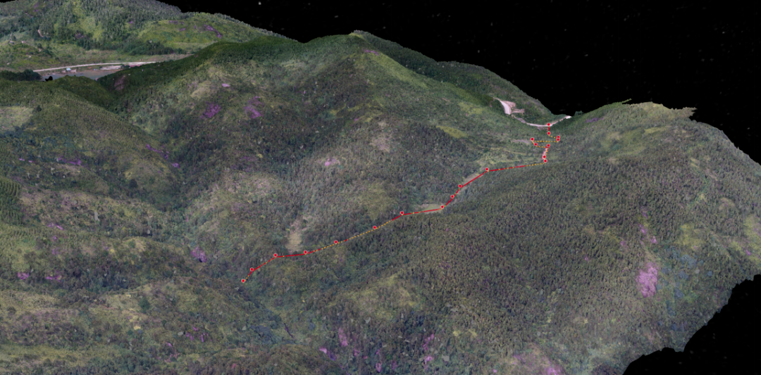
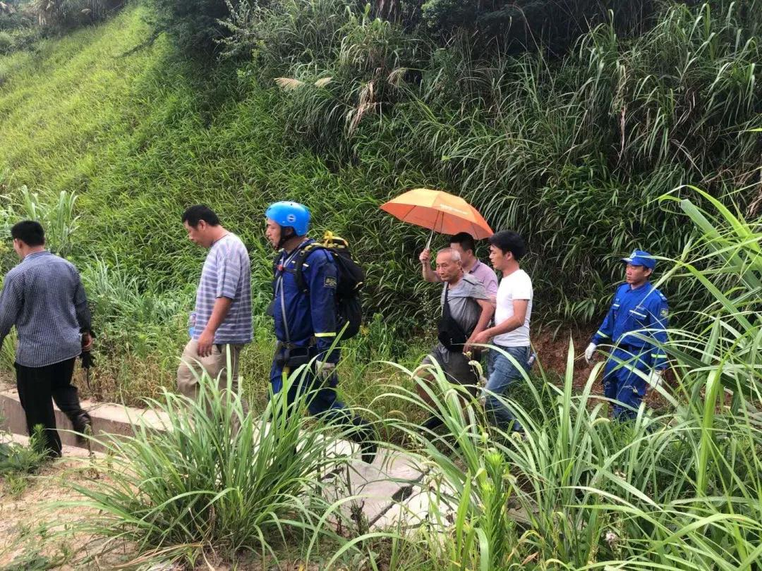
In September 2020, an old man from Huating Town, Chengxiang District, Putian City went to the mountain to pick mushrooms, but there was no news after that. According to the reporter, the old man had been missing for a day and a night. This area has high mountains, dense forests, and changeable mountain winds. The search area is nearly 10 square kilometers, and the altitude difference is 400-500 meters. There are communication dead spots in the mountainous valleys, and there is no mobile phone signal. Risk, the rescue mission is very difficult.
The Shenying UAV team of Putian Public Security Bureau rushed to the scene with the D2000 UAV system to collect efficient aerial images, use the UAV housekeeper software to collage and model the data, and plan the rescue team's uphill route through the 3D model , Guided the rescue team to go up the mountain quickly and purposefully, and finally successfully rescued the trapped elderly people in the evening of the same day.
Aiming at the difficulties and pain points in the field of emergency rescue, Foxtech Robot has launched a variety of emergency UAV system solutions.
Foxtech Robot emergency UAV system solutions cover multi-rotor, vertical take-off and landing fixed-wing, tilt-rotor and other models, which can be mounted with dual-light video module, visible light + thermal infrared module, orthographic module, tilt module, Infrared remote sensing module, laser radar module and other mission loads. Cooperating with the drone steward, it can quickly build two-dimensional and three-dimensional maps of the mission area and complete the rapid investigation of the mission area; through the handheld ground station and cloud service, the on-site video can be transmitted back to the ground command vehicle or command center in real time to achieve multi-level command and information sharing. With the support of a complete supporting product line, users can choose different types of drones to perform related tasks according to different application scenarios to meet the needs of various application scenarios.
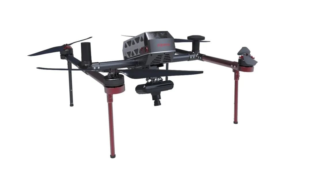
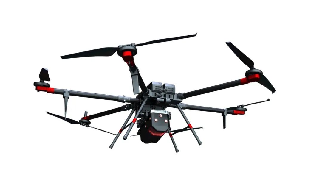
D2000S
Intelligent aerial survey/remote sensing/patrol inspection/emergency system D2000S is a multi-rotor UAV system that can meet high-precision surveying and mapping, remote sensing and video applications at the same time. The mission load adopts a modular design, which can be equipped with aerial survey modules, tilt modules, dual visible light video modules, visible light + thermal infrared video modules, thermal infrared remote sensing modules, and laser radar modules, with multi-source data acquisition capabilities; cooperate with UAV stewards It can realize precise 3D route planning, 3D real-time flight monitoring, GPS fusion solution, control point measurement, aero triangulation solution, one-click mapping, one-click export of stereoscopic mapping and other functions, and supports DOM, DEM, DSM, TDOM, etc. Processing and browsing of various data results; in addition, video application loads such as visible light video modules and thermal infrared video modules can be installed, equipped with long-distance image transmission, and realize functions such as target recognition, target positioning, real-time tracking of targets, and target speed estimation.
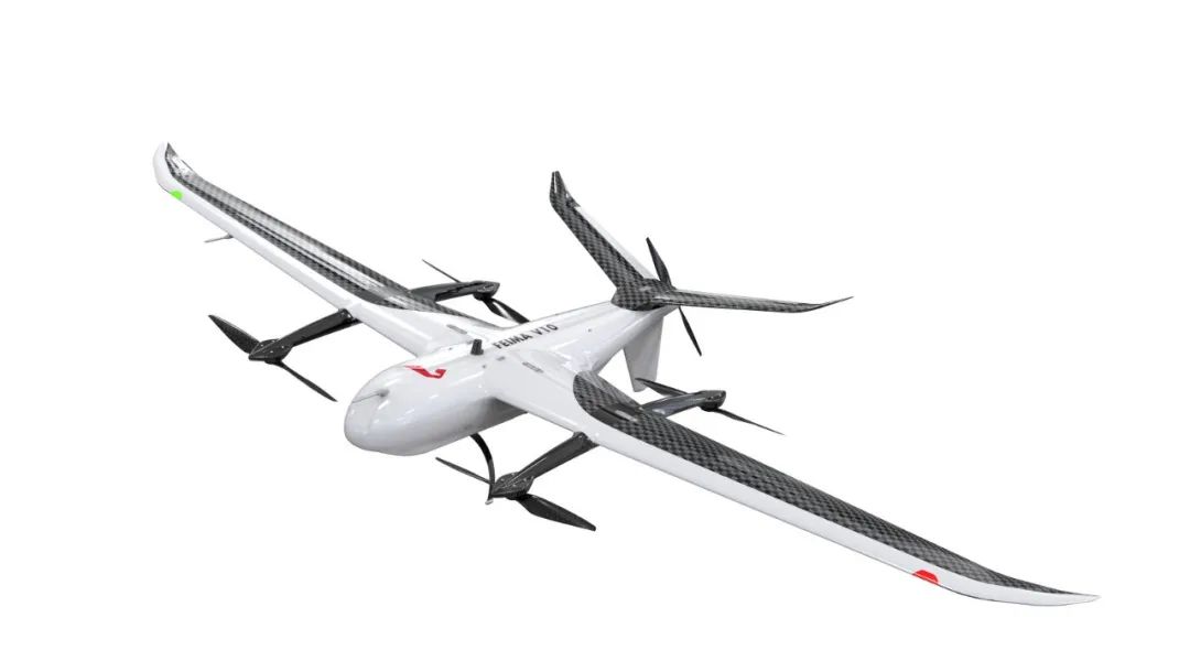
V10/D20
Intelligent aerial survey/remote sensing/patrol inspection/emergency system V10/D20 is a large-load, long-endurance, multi-functional, high-precision, high-efficiency UAV system—V10 is a large-load vertical take-off and landing UAV system, and D20 is a large Load-carrying multi-rotor UAV system. The product adopts industrialized and modular design, uses universal intelligent power battery and high-end load equipment, and can be equipped with aerial survey module, tilt module, video module, thermal infrared camera module, thermal infrared video module, multispectral module, hyperspectral module, laser Radar modules, synthetic aperture radar modules and some combination modules.
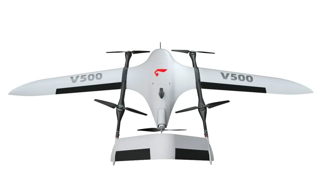
V500
Intelligent aerial survey/remote sensing/inspection system V500 is a lightweight, high-precision, long-endurance pure electric vertical take-off and landing fixed-wing UAV system independently developed by Foxtech Robot. The main focus is "high-efficiency data acquisition", "image-free control to map", "flexible and portable". The main material of the aircraft is Kevlar + PMI composite material. The take-off weight of the whole aircraft is only 7.2kg, and the battery life is as long as 180 minutes. The fuselage platform adopts a modular quick-release and folding design, which effectively reduces assembly steps and improves operating efficiency. The V500 has three options: orthographic version, inclined plate and vertical test version, to meet the customization needs of different users.
D500
Intelligent aerial survey/remote sensing/inspection/emergency system D500 is a newly developed high-performance multi-rotor UAV system that meets multi-industry applications. The whole machine adopts high-strength T700 carbon fiber integrated streamlined design, and the fuselage and motor adopt self-absorption heat dissipation structure , integrating high-precision differential GNSS boards, navigation GNSS modules, TOF sensors, millimeter-wave radars, visual perception systems, FPV cameras, and high-definition digital image transmission; core sensors are all redundant, safe and reliable. The D500 mission load continues the traditional modular design of Pegasus, equipped with aerial survey modules, tilt modules, laser modules, and multi-spectral modules, which can meet traditional aerial survey, real-scene 3D, and remote sensing monitoring applications; in addition, it is equipped with visible light video modules, thermal infrared video/ Remote sensing modules, megaphones, lighting, throwing and other application loads can meet the needs of aerial surveys, remote sensing, emergency, power line inspection and other industries.